Saturday 23 April 2016

Perth

Perth is close to a seven hour flight from Auckland. We traversed the southern reaches of Australia to get there.  It is the capital of Western Australia, a progressive city which has enjoyed relative prosperity due to the resource rich outback yet also subject to the ebb and flow of world demand for minerals and precious metals. The skyline is dominated by mining conglomerates, with one trying to outdo the other for emminence.
 

It claims to have the highest per capita of self made millionaires of any city in the world.  The prosperity is evident in the beauty of the city spreading along the coast and inland hugging the Swan River. As well as being the most isolated capital city in the world, Perth is the sunniest. This sun drenched city enjoys more sunshine which is reflected in the very warm summer temperatures, but wonderful when we were there in April.

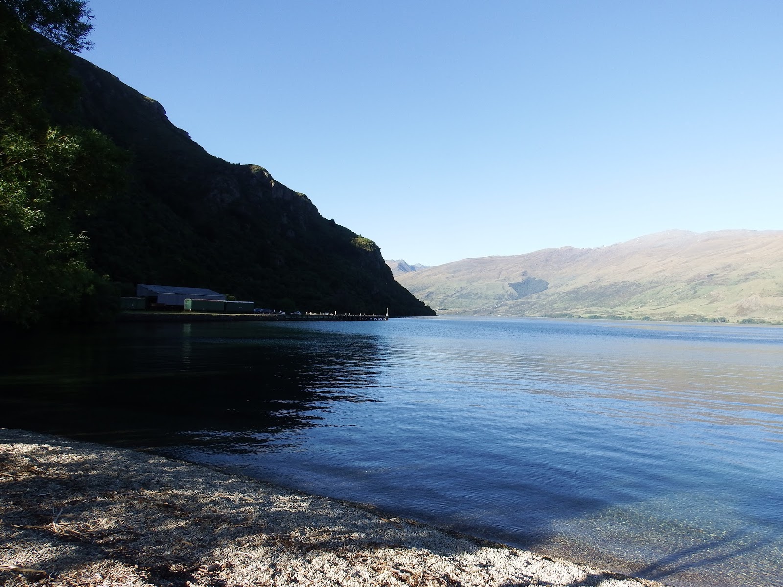
This is another city with a strong mariner tradition. The seaport at Fremantle is an example of engineering ingenuity.. The project involved blasting and dredging of the rocky bar to create a channel, dredging to deepen the river basin and construction of two moles to protect the entrance to the harbour. The scheme also involved land reclamation to allow for the construction of quays and warehouses.

On 4 May 1897, the official opening of 
the Inner Harbour was marked by the entry of the SS Sultana 2063-ton steamer on the Fremantle to Batavia and Singapore run. 

While the harbour has been deepened, 
and facilities extended and modernized 
over the years, the basic structure of 
the Inner Harbour remains essentially 
unchanged to this day, testament to 
the boldness, brilliance and foresight
of its designer. 
Kings Park is said to be one of the largest inner city parks in the world. We spent most of one afternoon traversing this beautiful green oasis.It lies on high ground offering a spectacular view of the city and inner harbour. 

The land on which Perth lies now, was once 
known as Boorloo. Boorloo formed part of 
Mooro, the tribal lands of Yellagonga, whose
group was one of several who lived around 
the Swan River, known as the Whadjug. The 
Whadjug was a part of the greater group of 13
or so dialect groupings which comprised of 
the south west socio-linguistic block still known today as Noongar [The People].


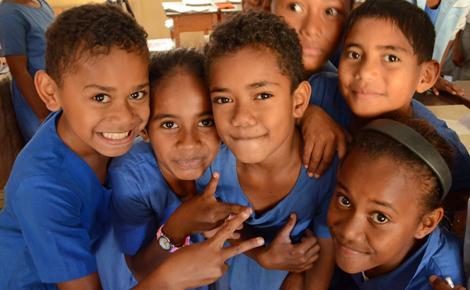
We spent most of our time 
training in Zone Conferences or meeting with missionaries. 
President Fife is an engaging and energetic leader and provided excellent instruction.  I had a clear impression the missionaries were in good hands under his able leadership.  We stayed in the Mission home and enjoyed their hospitality in their comfortable and spacious home.


On the day we had some time the Combs from Calgary, Alberta took us around Perth.  He was born and raised in Perth and knew the best places to take us. Their assignment is supporting missionaries whose second language was English.  This was the first senior couple who set a walking pace that even I had to adapt to.  A wonderful couple!


Friday 25 March 2016

Bula Fiji

 Our trip to Fiji was brought about by some unusual circumstances. A year ago, I had been asked to speak at a Church School Counsellor's Conference in Auckland.  After the talk, I was speaking to one of the counsellors and asked her to identify the next step the schools on the islands needed to take. Without hesitation, she said, "''We need to reach more of the kids who are struggling in our schools."  I immediately understood what she was talking about as that is a concern of most every school. Approximately 15 percent of the students struggle for a variety of reasons and responding to their needs is an ongoing challenge for teachers world wide,
A couple of weeks later I contacted our former School District [91] and asked what they were doing with the assessment resources from the years when I was conducting psycho-educational assessments. They said they were upgrading the kits and asked if I wanted the old ones.  I said yes!  That was the beginning of a long process to get them to New Zealand and arrange a means to train Counsellors and Administrators in the use of these resources.  Our first trip was to Fiji with more in the works. The school was less than a block away from the LDS Temple which is located at a high point in Suva, Fiji and is a guiding beacon for mariners, according to our taxi driver.
We had ten people in our training session and they were as excited and eager to learn how to use the materials as anyone I have worked with. After two days of training they expressed their gratitude and farewell with a warm and beautiful song in the gracious Fijian tradition.

Our stay was all too short.  We conducted the training at a Primary School - 430 kids from kindergarten to grade six.  They asked me to speak to the kids assembled as part of their sports day activities. Children throughout Fiji wear uniforms to school. Before school starts, during the morning rush hour, throngs of kids are walking in groups or climbing onto windowless buses. Given the number of young people I saw, I gather that large families are the norm.

Of all the islands, Fiji has capitalized most on the tourist trade with approximately 25 percent employed in various facets of the tourism industry. Fiji is a mix of Polynesian, Melanesians and Fijians of Indian descent. Their limited financial resources does not take away from their demeanor as everywhere we wen,t we were greeted with smiles and friendly greetings. "Bula!'


While we were in Suva a cruise ship was disembarking near our hotel and there were signs and preparations being made in spite of it being early on a Sunday morning. There are 333 islands that comprise the Fijian chain and resorts are on many of them. This warm tropical paradise is a drawing card for tourists from Asia, Australia, New Zealand and the U.S.


Saturday 23 January 2016

Cathedral Cove

 On the east coast of the Coramandel Peninsula is a beautiful beach known as Cathedral Cove. Not only the beach but the whole area offers considerable appeal. The views from the trail down to the beach provide stunning vistas, interesting geological formations and evidence of the dramatic sculpting of wind, rain and waves. The hike down from where this picture was taken was approximately 45 minutes with a few side track options for the more adventurous types.

A gorgeous day greeted our early departure from Auckland. We wanted to get ahead of the masses who would no doubt venture out, it being a Saturday, mid summer and a popular  retreat for Kiwis and tourists alike.

One of the first features to attract my attention was the chalk white cliffs which were even more impressive in the morning sun. This rock is known as Ignimbrite. A close up look at the rock reveals an angular shaped blocks of pumice deposited in the form of ash from past cataclysmic
 volcanic explosion(s).  Normally this type of deposit surrounds a caldera.  In this case with upheavals of land and seabed the original structure has long since been deformed and reformed.

New Zealand is a continent in transition.  Since its departure from Gondwanaland 85 million years ago it has undergone constant tectonic restructuring.  Some parts of New Zealand are as much as 450 kilometres from their original locations. Volcanic eruptions have further shifted huge chunks of land vertically in the space of a few minutes, as we observed in Christchurch.

Yet the sculpting influence of wind and water are evident here as well.. This relatively soft rock is subject to the relentless pounding surf, carving arches, shaping rocks, leaving a residue of soft whites sands as evidence of its innate artistic capacity.


 The waters were too warm to resist.
This is the first time I went swimming and wondered what had taken me so long. I swam out to one of the big rocks (not this one here) and climbed on top and dived off. This was a reminder that swimming requires some conditioning and I found my self having to work at it to navigate the surf, swells and effects of tide.  Never the less it was all fun and certainly worth the effort.

 Aptly named Cathedral cove, this archway framed one of the most picturesque views I have seen while here in New Zealand. This proved to be just what I needed to rejuvenate from the emotional demands of the work.  Arendje seems to enjoy it as much as I do, although the treks into some of these places makes her somewhat less excited.

 The appeal of this beach explains the number of people present.  We got here relatively early and a steady stream of trekkers continued to come as we headed back up the trail.
 This view is taken from the trail head overlooking the islands off the coast. The Winters the couple to our left are our regular travelling companions.  The young couple beside them is their daughter and son in law visiting from Salt Lake area.

A number of tourists and locals opt for a kayak or boat tours to the beach, certainly a less arduous way to get there.  I saw a few working there way around this promontory.  In fact in this picture were magfnified you might see them

Saturday 9 January 2016

Wellington by Train

 We decided to take the train to from Auckland to Wellington with the intent of perhaps enjoying a different perspective of the beautiful North Island countryside.  I personally was not disappointed.  Eleven hours all told, with frequent short stops along the way.  The weather was accommodating, the seats comfortable and enough variation to keep it interesting in spite of the extended day.
The topography does not change appreciably over the 649 kilometer trip. Green hills most with of them devoted to sheep and cattle farms.  We navigated some precipitous terrain as well with deep canyons, dense subtropical forests and breathtaking views. During one portion of the trip we had to navigate a rather cirutious route called the Rauimu spiral.  a rather notable engineering feat that rises 139 meters which begins with a horseshoe curve

Legend has it that a train driver once emergency braked his train in the night upon mistaking the light of his last wagon on a nearby part of the spiral as the rear of a different train directly ahead of him.

Our first day in Wellington was spent doing training with the Wellington Mission Zone Leaders and the Sister Training Leaders. The next day we visited various sites.

On the outskirts of Wellington is a site referred to as the Weta Workshop where all the animations and puppets for Lord of the Rings and a host of other movie sets were designed and constructed.

 The incredible attention to detail and life like creations were indeed impressive. A number of tour options were available. We opted to explore the museum and watch a short video presentation of the process of construction involved in making the props and often gruesome characters.

The story behind the development of the Company' from it's humble beginnings speaks to the vision, imagination and creative capacity of these early entrepreneurs. The facilities now encompass acres of land and are devoted to various aspects of set construction and design.


Peter Jackson the Director of Lord of the Rings went to great measures to ensure the depiction of characters was true to the form described in the novel. Being attentive to detail the end products represent works of art, creative adaptions designed to comply with the demands and constraints of the isolated movie sets.


For the tourists bronze figurines were intricately sculpted and on display and the price reflected the creative genius of the artisans. They would be an odd addition to a mantle piece, but would certainly capture the attention and the imagination of the beholder. Although tempted, these were well beyond my budgetary limits, yet still managed to captivate the visual possibilities.


The scope of the Lord of the Rings influence in New Zealand is quite remarkable. In a number of locations Kiwi's have capitalized on the tourist potential of these landmark movies and established venues to showcase New Zealand's diverse topography and capture the mystical elements of this enchanted land portrayed in the trilogy.


From there we took a bus back to Wellington to embark on an up hill adventure.  Wellington is best understood and appreciated when compared to the terrain of another well known tourist city - San Francisco. The train/tram took us on a seemingly impossible

climb to the top of a ridge. At the summit was a botanical garden covering the whole hillside overlooking the city in almost every direction.  The combined visual appeal of the of garden and the vista from the hill proved to be a unique combination.


We proceeded to follow the trails down the hill taking in the colour, fragrances and beauty of the surroundings.  This setting, ideal weather and good company made for a most pleasant afternoon.

Wellington also boasts a world class museum on the water front,  In fact the whole waterfront has been revitalized from an industrial dockyard to a well designed promenade featuring prominent historical landmarks, viewpoints and quaint shops, restaurants and walkways and all easy access from downtown.

Much more time could have been spent here. Whenever I find a place that offers a number amenities I imagine myself living there. Wellington is one of those places I could easily see myself enjoying.


Saturday 2 January 2016

New Zealand South Island - An overview

The south island of New Zealand lies roughly from 41 degrees south latitude to 47 degrees.  It can be described as a cool temperate climate with plentiful rainfall. It does snow at sea level, but more inland and at higher elevations. Extremes of temperature are rare given the moderating effects of the ocean.

Severe weather is not a common concern, although every eight or nine years a cyclone will come through the islands wreaking serious damage.  Flooding landslides and losses of life at sea are the usual result. New Zealand sits on two tectonic plates - the Pacific and Australian and some parts of the South Island while the rest of the South Island sit on the Pacific.  It is seismically active. When we were on the South
Island I felt the effects of one of their frequent earthquakes

Over thousands of years, through the process of subduction, parts of the coastal mountains become submerged, creating impressive sounds and fjords. In Milford Sound we saw a good example of this which I cover in a later post. Needless to say the channels offer some of New Zealand's most picturesque scenery.

We flew, drove and and took bus and boat tours to see the length and breadth of this island.  A week of course is not enough, but it did provide a cross section of what the South Island had to offer. You do not have to go very far before another photo opportunity would present itself.  Unlike the north island, the population density is significantly lower making for frequent and prolonged natural landscapes as we traveled.

The "southern alps' constitute the back bone of the island. Travelling east to west means a mountain pass or two  is required. Glacial fed lakes, impressive mountain vistas and untouched wilderness reminded me of much of British Columbia.  Both share a common heritage as the mountainous terrain represented a daunting obstacle to early road and rail construction.


The last two photos are from the beach of our rental property in Kingston in the interior of the island. This small, rather remote setting was the staging point for our tours and ventures out to points of interest. It served as a peaceful reprieve from the throngs of tourists in the larger centers.


Saturday 28 November 2015

Bay of Islands


What has to be one of the premier tourist spots in all of New Zealand is the Bay of Islands,  In the north east corner of the north island is an archapeligo of 142 islands.  This is referred to as a Ria Coast essentially referring to a submerged land with only the higher points visible above the water line. The islands and jagged coast line provide bounteous sheltered bays, harbours, peninsulas and islets.

In addition to being an ideal boating and tourist venue, it is also well known for its fishing and marine habitat for whales, porpoises, seals and other marine life.  We took full advantage of this visually stunning area to tour the  islands, take pictures and overall have a wonderful day.

These islands were settled early by the Maori given the plentiful food supply and today the largest tribe is found here. Some of New Zealand's most famous Maori chieftains originated here.

As expected this represented an ideal landing spot for early explorers. Captain Cook and a series of early adventurers made their first encounters with the Maori's here not without a number of fractious exchanges.  It makes for some interesting reading. As Eurpoean settlers were drawn to the location at the end of the 18th century, so too were the less savory sojourners in the form of whalers and later peaceable missionaries. This in turn generated further cause for conflict eventually leading to the need for some political resolution between the contending parties.
 
We ventured out amidst the islands on an overcast day, yet pleasant enough.  In fact the clouds allowed us to avoid the sharp contrasts the sun imposes on our picture taking efforts. We saw whales, stopped and hiked on one of the islands and enjoyed the on board commentary of the historic significance of various spots along the way.

As our boat approached the furthest reaches of our trip, there was some excited anticipation of what we were told would be the highlight of the
journey.  Piercey Island is a much revered  ceremonial location of the Maori.  It is referred to as hole in the rock and tour boat operators regularly take passage through this breach in the island. At first sight it did not look like our boat would fit, but as we approached, the true proportions of the rock channel made us believers.

The choppy seas settled under the protective cover of the rock walls and we made safe passage through with not a lot of room to spare.  Arendje's smile I thought captured the magic of the moment.

We never saw our promised porpoises so they gave us another pair of tickets to come again another day.   I don't know if we will have the opportunity, but I would certainly welcome another trip.  We had a relatively small group on our boat as we took it during the winter months to avoid the summer throngs.


The rest of the day was spent visiting some of the historic towns, taking
 tours of the Treaty Grounds which I will cover in another blog post.

Russel is one such town which has a colourful past, it being a stopping point for the early whalers.  Long weeks and even months at sea left them ready for some revelry and raucous behaviour when landfall was finally made. Local settlers bemoaned their arrival as there presence had an unsettling effect on everyone nearby.

Early New Zealand  immigrants had to be a hardy lot as limited supplies and vast distances made the
likelihood of enjoying the former
amenities of their homelands, costly
to ship, requiring long waits
between resupply.

Relationships between settlers and Maori slowly warmed,  settlements expanded and many of the Maoiri settlements begun here expanded south.  Okiato was the nation's first capital.  Another important location was Waitangi where the Treaty of of Waitangi would later be signed.  Kerikeri as the staging point for the inland Maori to go to sea and the site of the first mission station in the
country.


Friday 27 November 2015

Tahiti

 Tahiti consists of two islands; Tahiti Nui and Tahiti Iti two currently inactive volcanic fields. They are linked by a narrow isthmus. The larger island has a road that circumnavigates the island which we explored with a senior missionary couple  on our second day on the island.  We then took the isthmus to cover just a small part of the second island and made our way to the top of a look out to view the larger island from the elevated position.

Polynesians arrived on the islands during the first millenia AD built habitations mostly in the interior. Like many of the islands,  conflicts erupted frequently among various tribes  so allegiances and complex alliances with neighbouring family tribes were arranged to gain greater control and maintain a foothold on their land.

Robert Louis Stevenson dubbed this an island paradise with the nicest people in the world.  To this day they are characterized by their friendly laid back nature. There are strong connections with christian religions .  Every 4 or 5 kilometers along the perimeter highway is an LDS chapel.  Ten percent of the islanders are members with 23 chapels on the main island of Tahiti.

The main industry is of course, tourism, with fishing, shrimp farms, pearl farming and sugar cane farms.   The French government provides most of the infrastructural support, although they are attempting to reduce their influence financially, and politically. Like many of the islands the economy is subject to the ebb and flow of the tourism dollars.

The population is predominantly Polynesian with a notable south east Asian population.  French professionals and political personnel make up the rest.  Most of the better jobs go to the French and Asian residents.  The Asians are intermarrying thus changing the cultural dynamic and composition.

The climate as expected is hot and humid. The week we were there the temperature hovered
around the low 90's with only one day of rain.   I think we were entering the dry season, although everywhere the lush vegetation gave ample evidence of abundant rain.

We were there to train and support the missionaries.  Most of them speak French with some able to speak Tahitian.  My French was not sufficiently good to do my presentations without an interpreter. For two mornings I conducted training with approximately 120 missionaries on stress management and in the afternoon met with missionaries who requested additional
 support.
That amounted to 25 missionaries over a two day period.  A number of them only spoke French so I had to really pay attention to understand them. With sign language and their patient forbearance we were able to make ourselves understood.

We stayed in a hotel the first two days and then at the Mission Home. The Mission President and his wife were originally from France, but had moved to California.  The mission was doing well, in terms of baptisms as the Tahitians are quite receptive and work closely with members.

We quite enjoyed our short stay on the island recognizing there are some unique challenges for those who live there.  Tahitians more than most other islanders stay on the island, rarely venturing to larger centers for education or better job opportunities.
In many ways their life style has appeal, but the economics makes fore some challenging times for the families.

The Bize's saw us off at the airport. A wonderful couple serving and leading a great group of missionaries!
 These arrived the day before.